HOME /ATAK PLUGINS & DATA PACKAGES /FUEL INTEL — OFFLINE U.S. FUEL & STORAGE SITES | KMZ FOR ATAK, TAK AWARE & GOOGLE EARTH
Fuel Intel — Offline U.S. Fuel & Storage Sites | KMZ for ATAK, TAK Aware & Google Earth
SKU: D47-FI-AL
When the power goes down, every pump in town stops at once, and the station on the corner is where everybody goes first. The fuel doesn't vanish. It sits in tank farms, dealer yards, fleet depots, farm tanks and generator day-tanks that no gas-finder app will ever show you, and your phone's map goes dark with the cell network anyway.
WHY IT'S IN THE SHOP
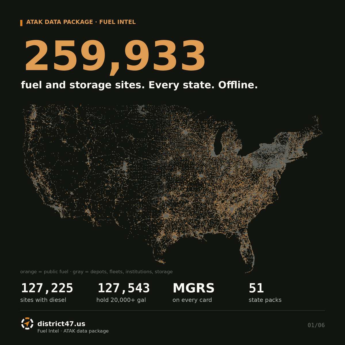
Fuel Intel maps 259,933 places fuel is sold or stored across all 50 states and DC, from federal and state tank registries, into ATAK layers that work with no signal and no GPS. It sits next to Water Intel as the second half of sustainment: where the water is, and where the fuel is.
WHAT'S INSIDE
- 132,842 retail stations, plus 2,404 truck stops and toll-road service plazas, 1,882 marine fuel docks and 2,591 aviation fuel sites
- 127,225 sites that store diesel, flagged on the pin itself
- Bulk supply: 1,762 bulk terminals and tank farms, 119 operating refineries, 201 petroleum ports, and 4,378 heating-oil and propane dealer yards
- Propane: 3,852 refill, Autogas and registered storage sites, plus 10,183 E85, CNG, LNG, biodiesel and hydrogen stations
- Restricted stockpiles: 10,742 public-works yards, 2,250 transit depots, 3,949 police, fire, EMS and Guard sites, 3,706 hospitals, 6,213 schools, 3,157 telecom exchanges, 5,128 utility sites, 4,685 farms and 30,784 commercial fleets
- A card on every pin: fuels by tank with gallons, total storage, tank age, who can buy there, street address and county, highway milepost where known, 100-year floodplain flag, Lat/Lon and an MGRS grid reference
- Pins you can read at a glance: color is who controls the site, the pictogram is what it is, a D chip marks diesel, and a corner dot shows storage (green 20,000+ gal, amber 8,000–20,000, red under 8,000)
FILES
Pick your state. Each download is a zip with that state's KMZ file(s), a README and an icon legend. Most states are one file. Larger states are split along county lines so every file loads on a phone (all under 18 MB), and metro areas are kept whole; the one exception is Harris County, Texas, which is too big for a single file and is cut in two. Florida 10, Texas 8, California 6, New York 5, Michigan 4, Pennsylvania 4, Georgia 3, Illinois 3, North Carolina 3, Ohio 3, Virginia 3, Alabama 2, Colorado 2, Indiana 2, Minnesota 2, New Hampshire 2, New Jersey 2, Tennessee 2, Wisconsin 2. Files are named by region and city, for example TX_Southeast_Houston_Pearland, and the README lists the counties in each one.
FIELD NOTES
Storage is registered tank capacity, not what's in the tank today. EPA's underground-tank data reflects 2018–2021 state reporting, so some stations have opened or closed since. Twelve state tank registries (Texas, New York, Mississippi, Ohio, Virginia, Florida, Michigan, New Hampshire, Alaska, DC, Colorado and Pennsylvania) fill in fuel type, add aboveground tanks EPA never covers, and remove stations whose tanks are gone. Sites whose source lists no fuel type show "FUEL TYPE N/R" and no diesel chip. Almost every dispenser needs grid power. Restricted sites are marked restricted: they show where fuel is held, not where you can buy it. Private homes are never included.
Load it: ATAK → Import Manager → Local SD → the .kmz. TAK Aware: share the .kmz to the app. WinTAK: Import → Local file. Google Earth: File → Open.
Sources: EPA UST Finder, EPA Facility Registry Service, DOE Alternative Fuels Data Center, BTS National Transportation Atlas, EIA Refinery Capacity Report, and state tank registries: Texas TCEQ, NYSDEC Petroleum Bulk Storage, Mississippi MDEQ, Ohio BUSTR, Virginia DEQ, Florida DEP, Michigan EGLE, New Hampshire DES, Alaska DEC, DC DOEE, Colorado Division of Oil & Public Safety and Pennsylvania DEP. Public records; District47 does not verify individual sites.
THIS IS REFERENCE DATA ONLY! I DO NOT CONDONE THE USE OF THIS INFORMATION IN ANY NEFARIOUS WAYS. PLEASE USE RESPONSIBLY
DISTRICT47