District47
FREE: Appalachian Trail ATAK Overlay — 1,717 Waypoints, Categorized and Ready to Load
FREE: Appalachian Trail ATAK Overlay — 1,717 Waypoints, Categorized and Ready to Load
Couldn't load pickup availability
Every shelter, campsite, bridge, restroom, and parking area along all 2,190 miles of the AT — pre-categorized into toggleable layers for ATAK, Google Earth, and any KML-compatible GPS. Instant download.
Full description
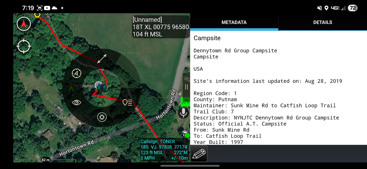
Stop flipping between ten different apps. This single KMZ overlay puts every official Appalachian Trail waypoint on your ATAK map, organized so you can toggle exactly what you need.
Built from the Appalachian Trail Conservancy's official waypoint dataset and repackaged specifically for ATAK and KML-compatible mapping software. Each waypoint retains its full source metadata — maintainer, trail club, year built, county, status — so when you tap a shelter icon, you get the real context, not just a dot on a map.
What's inside
- Shelter (282) — every official AT overnight shelter, red square icon
- Campground (230) — designated tent sites, green tent icon
- Restroom (315) — facility locations, orange toilet icon
- Bridge (408) — trail bridges with build dates and maintainer info, cyan icon
- Parking Area (482) — trailhead access points, white parking icon
Why this format
- Five independent folders in ATAK's overlay manager. Show only shelters when planning a thru-hike. Show only parking when scouting day hikes. Toggle instantly.
- Distinct icon shape AND color per category — readable at a glance even at state-level zoom.
- Full ATC metadata preserved in each waypoint. Nothing stripped.
- Single KMZ file, ~107 KB. Loads instantly, works offline.
Who it's for
- ATAK users running tactical or overlanding kits who want hiking data in their existing map stack
- Thru-hikers and section hikers who want an alternative to FarOut's subscription model for offline planning
- Backpackers who prefer one file across Google Earth, Gaia GPS, CalTopo, and their handheld GPS
- Search and rescue teams, trail crews, and anyone who needs the AT on the same map as everything else they're running
Compatible with
ATAK · WinTAK · iTAK · Google Earth · Google My Maps · Gaia GPS · CalTopo · Garmin BaseCamp · any KML/KMZ-compatible mapping software
What you get
-
Appalachian_Trail.kmz— instant download after purchase - Load instructions for ATAK (Import Manager → Local SD → KML/KMZ)
Disclaimer:
The filles attached are for research and information only. Do not use them to depend on your survival when on the trail. Be smart and do your thorough research when planning your route or hiking.
Good luck! God Bless!
Share