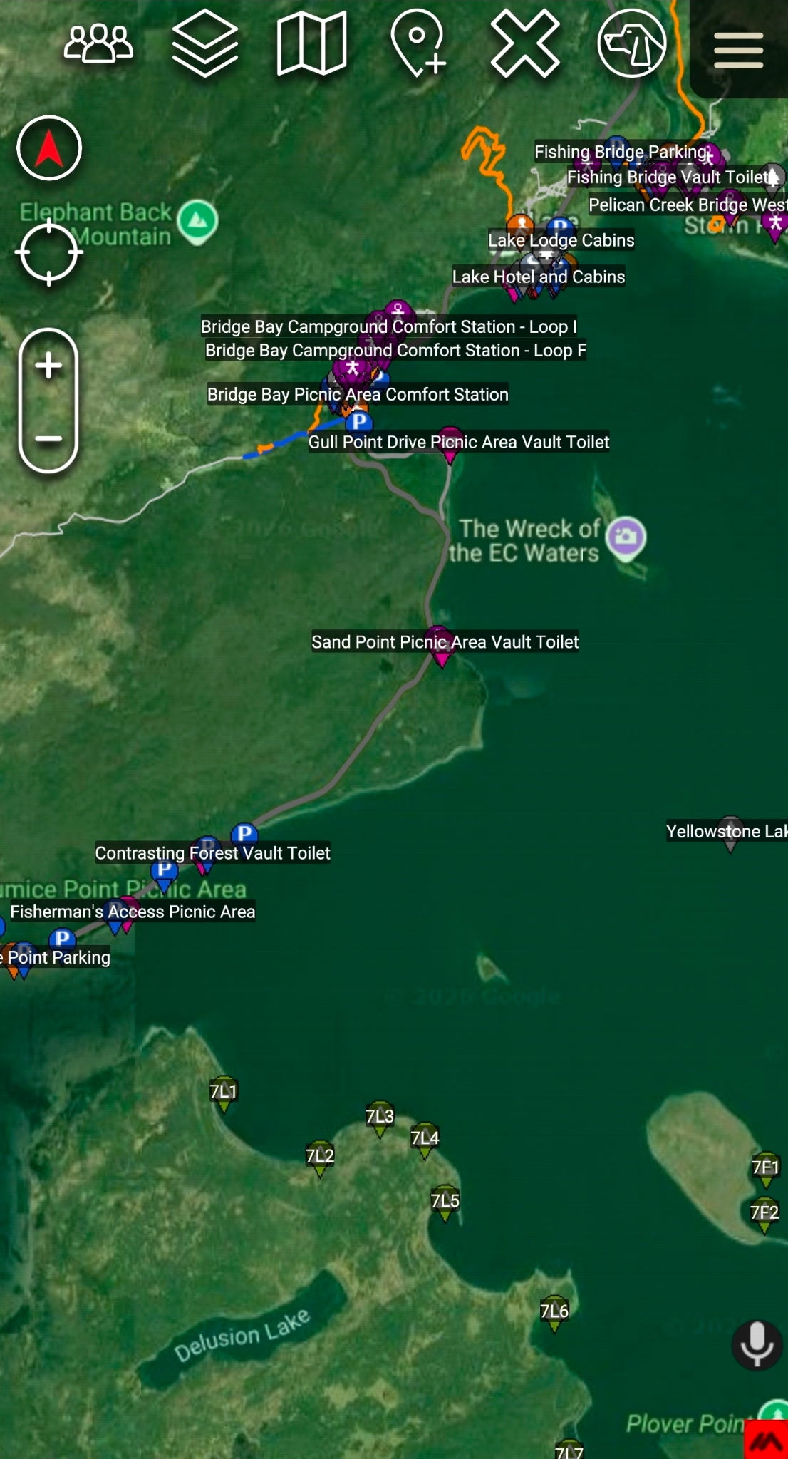
One KMZ file. Every one of the 63 U.S. National Parks — boundaries, entrances, trails, roads, and over 15,900 points of interest, all organized, color-coded, and ready to import. Built from official National Park Service datasets and packaged for ATAK by District47.
No subscriptions. No accounts. No cell service required. Once it's imported, it lives on your device and works 100% offline — the way field gear should.
What's inside:
-
All 63 National Park boundaries — official NPS boundary polygons with park info and quick links (including Alaska, Hawaii, USVI, and American Samoa)
-
15,900+ Points of Interest with 27 custom icons — entrance stations & exits, visitor centers, ranger stations, campgrounds & backcountry campsites, trailheads, restrooms, water, food, lodging, fuel, overlooks, waterfalls, boat launches, historic sites, and more
-
14,600+ trails, color-coded by use — orange hiking, blue bike/multi-use, purple equestrian, red motorized/OHV, cyan winter/ski, navy paddle. Tap any trail for name, length in miles, surface, class, and status
-
13,200+ roads styled by class — primary, secondary, local, 4WD/high-clearance, and service roads with surface and seasonal info
-
3,100+ parking areas, shuttle stops, and transit points
Organized the way you actually use it:
Every park is its own folder with subfolders for Entrances & Exits, Visitor Centers, Campgrounds, Trailheads, Trails, Roads, Parking, Amenities, and more. Toggle on only what you need — keep the map clean and the app fast. A full icon and color legend is built into the package.
Perfect for:
-
Overlanders & off-roaders planning park routes
-
Hikers & backpackers who navigate in ATAK
-
SAR teams and rangers needing a shared parks overlay
-
Anyone running an offline-first setup (pairs great with your Meshtastic nodes and downloaded base maps)
Specs:
-
Format: KMZ (KML zipped with embedded icons)
-
Size: ~4 MB
-
Features: 47,000+ placemarks
-
Compatibility: ATAK (Android Team Awareness Kit), ATAK-CIV, and any app that imports KMZ (Google Earth, Gaia GPS*, and others)
-
Delivery: Digital download — nothing ships. Import instructions included (PDF guide)
-
Data source: U.S. National Park Service public datasets, compiled 2026
Good to know:
First import takes 30–60 seconds on older devices — that's 47,000 features loading, not a freeze. Trail and facility data reflects the latest published NPS datasets; always verify current conditions and closures with the park before you go.
Some apps render KMZ differently; this package is designed and tested for ATAK.
Questions before or after your purchase? Message us anytime — we actually answer.