HOME /ATAK PLUGINS & DATA PACKAGES /EVACUATION ROUTES, SHELTERS & FLOOD ZONES | OFFLINE MAP FOR ATAK, TAK AWARE & GOOGLE EARTH
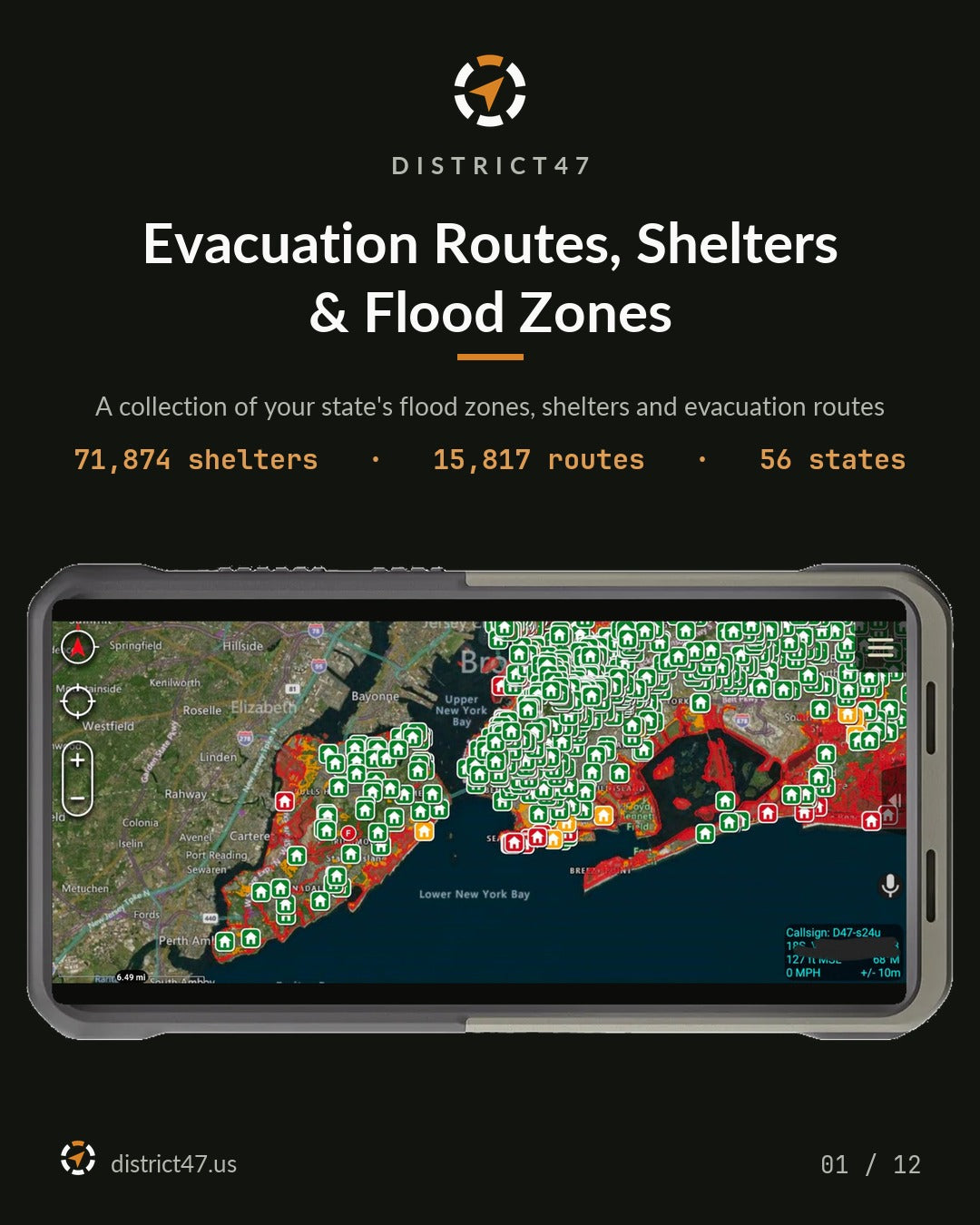
Evacuation Routes, Shelters & Flood Zones | Offline Map for ATAK, TAK Aware & Google Earth
SKU: D47-ER-AL
FEMA publishes the national shelter list with coordinates that are frequently wrong. Not slightly wrong. A high school in Vernon, New Jersey is published 156 km away in Camden. A school in Gurabo, Puerto Rico is published in San Antonio, Texas. Navigate to the point as published and you arrive at a parking lot, a town centre, or the wrong county — on the day you can least afford it.
This package moves them. All 71,874 shelters are re-plotted from their street address onto the actual building, and every pin tells you how its position was established and how far it moved. 62,198 (87%) landed on a school record or a verified street address. The rest stay on FEMA's published point and are labelled unverified — no guessing, no silent fudging.
WHY IT'S IN THE SHOP
The shelter list and the flood maps already exist — on two different websites, both of which need signal. This is one file per state that opens with the network down, and it answers the question the websites can't: is the shelter I'm driving to inside the floodplain, and does the road I'm taking go under before I get there?
WHAT'S INSIDE
- 71,874 emergency shelters — capacity, evacuation vs post-impact use, generator, wheelchair access, pet policy, address, and the FEMA flood zone at the corrected location
- FEMA flood-zone shading — 100-year and 500-year floodplain painted across every state, as a separate toggleable layer
- 15,817 evacuation route pieces, each graded by how much of the road runs through the floodplain, so the route that floods first is red before you drive it
- 577 evacuation-zone pins carrying the A/B/C lettering your county actually calls on the radio
- 3,229 county flood summary pins — how much of the county is in each floodplain and how many shelters sit inside it
- Every pin shows its own work — a Location row ("on the building — school record", "on the street — Census address match", "FEMA pin, could not verify") with the distance moved, plus an independent check graded against county, ZIP, house number, duplicate pins and whether the school still exists. 82% grade High or Medium; the rest are badged CHECK LOCATION on the map
COLOR CODE
- Shelters — RED in the 100-year floodplain · AMBER 500-year · GREEN outside · GREY not rated
- Routes — RED 250 m+ of road in the 100-year floodplain · AMBER a short crossing · GREEN outside
- Shading — RED 100-year (1% annual chance) · AMBER 500-year (0.2%)
- County pins — RED 5%+ of the county in the 100-year floodplain · AMBER 2–5% · GREY under 2%
FIELD NOTES
Evacuation routes exist for 16 of the 56 files. Zones exist for 9. That is not a gap in this package — those datasets are not published anywhere for the other states. The national route archive only maps hurricane evacuation, so it only covers the Atlantic and Gulf; a handful of states publish their own on top of that (Florida, Virginia, Louisiana, South Carolina's lane reversal, Pennsylvania's nuclear routes, DC's regional routes) and those are included. Inland states direct traffic during an emergency rather than pre-designating routes. Every one of those 40 files says so in its own README, and shelters plus flood shading are in all 56.
Puerto Rico, the US Virgin Islands, Guam, American Samoa and the Northern Marianas carry a warning in their README: rural addressing there (carretera and kilometre markers rather than street numbers) defeats every public geocoder, so most of their pins stay on FEMA's point. Those files are a reference to the official shelter list, not survey-grade positions.
Shelters are pre-identified sites, not a live list of what is open. Confirm with county or state emergency management, or 211, before you go. Flood ratings are a planning screen against FEMA's flood maps, not a surge model — bridge decks are not counted. Always follow official evacuation orders.
SOURCES — FEMA ESF#6 National Shelter System · FEMA National Flood Hazard Layer · HIFLD Hurricane Evacuation Routes · state emergency management layers (FDEM, VDEM, NCEM, SCEMD/SCDOT, GEMA, MDEM, DEMA, NJOEM, CT DEMHS, GOHSEP, PEMA, DC HSEMA) · NCES/IPEDS school locations · US Census Geocoder. Public data; planning use only. Personal use, no redistribution.
DISTRICT47 · district47.us