HOME /FREE DATA PACKAGES /ALPR WATCH — 144,531 LICENSE PLATE READERS | FREE ATAK PLUGIN WITH DRIVE ALERTS & OFFLINE MAPS

ALPR Watch — 144,531 License Plate Readers | Free ATAK Plugin with Drive Alerts & Offline Maps
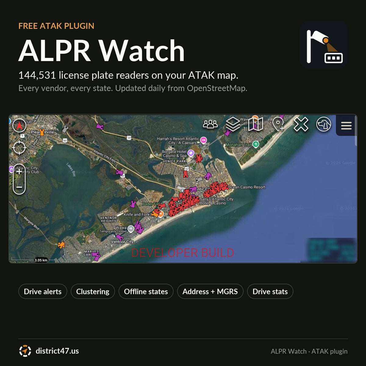
A camera map in a KMZ is out of date the day you load it, and 120,000 pins in one file is enough to stall ATAK on most phones. ALPR Watch puts every mapped license plate reader in the US on your ATAK map, 144,531 of them as of October 2026, keeps them current every day, and warns you before you drive past one.
WHY IT'S IN THE SHOP
Flock Safety, Motorola (Vigilant), Genetec, Axis, Leonardo (ELSAG) and a dozen smaller vendors have put plate readers on poles, traffic lights and store lots across the country. Volunteers with the DeFlock project map them into OpenStreetMap: location, vendor, operator and which way the camera faces. ALPR Watch takes that data, cleans it up on our server, and serves it to ATAK so it stays current without anyone re-downloading a file. It is free, like the data it is built on.
WHAT'S INSIDE
- 144,531 cameras, every vendor. All 50 states, DC, Puerto Rico, the US Virgin Islands, Guam and the Northern Mariana Islands. 98% have a mapped facing direction.
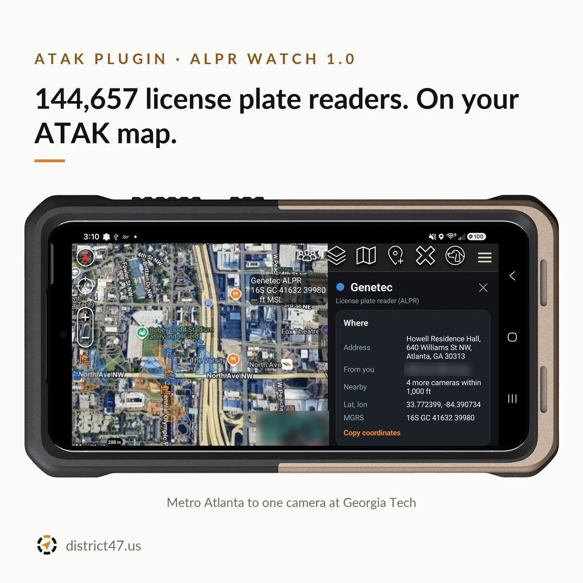
- Direction on the map. Each camera is colored by vendor and points the way it faces. Zoomed in, a translucent cone shows its field of view.
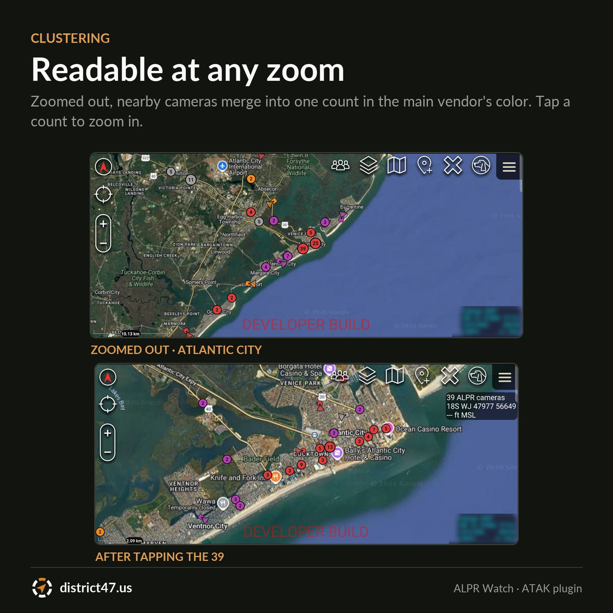
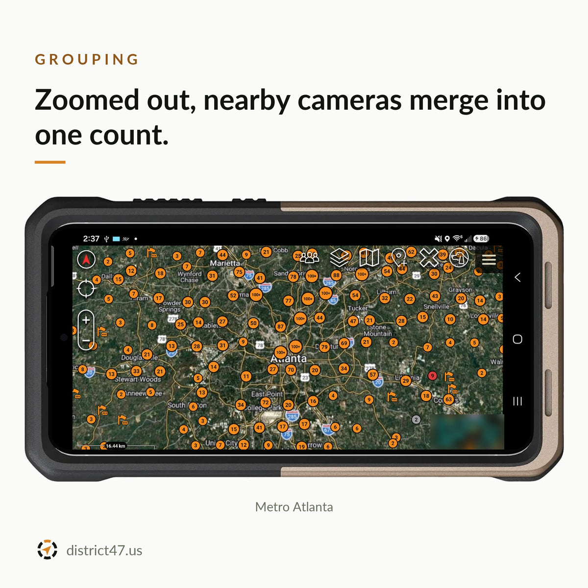
- Clustering. Zoomed out, nearby cameras merge into one count in the main vendor's color. Tap a count to zoom in. Atlantic City reads as a handful of counts instead of a solid block of overlapping pins.
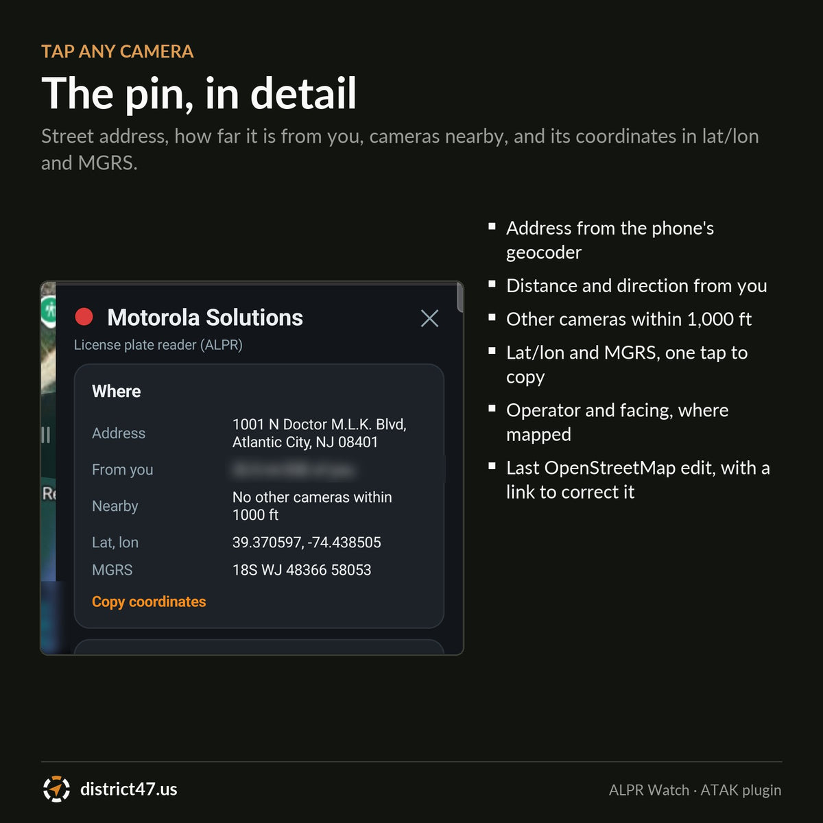
- Pin details. Tap a camera for its street address, distance and direction from you, other cameras within 1,000 ft, latitude/longitude and MGRS (one tap copies both), operator and facing where mapped, and the date of its last OpenStreetMap edit with a link to correct it.
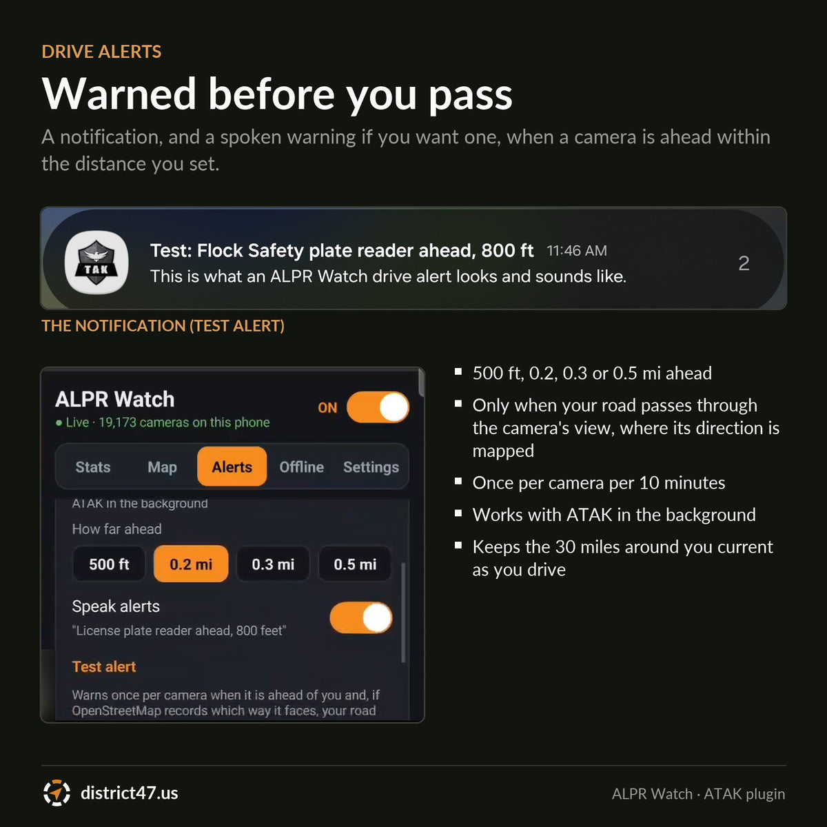
- Drive alerts. A notification with sound and vibration, and an optional spoken warning ("License plate reader ahead, 800 feet"), when a camera is ahead of you within 500 ft, 0.2, 0.3 or 0.5 mi. Where the camera's direction is mapped, it warns only if your road passes through its view. Once per camera every 10 minutes. Works with ATAK in the background.
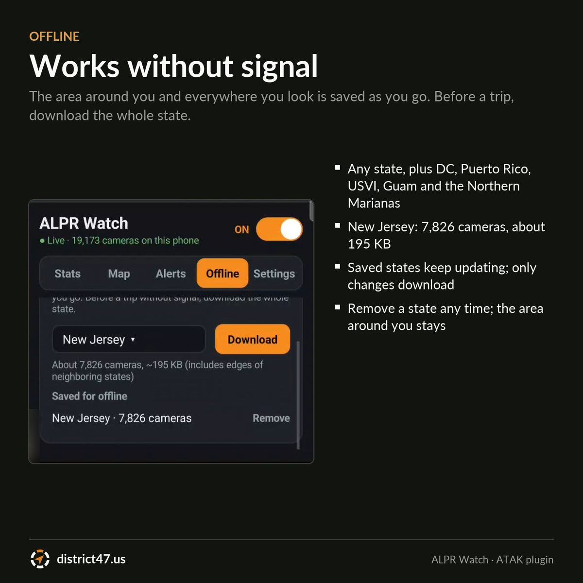
- Offline. The area within 30 miles of you and everywhere you look is saved on the phone as you go. Before a trip without signal, download any state from the menu: New Jersey is 7,826 cameras in about 195 KB. Saved states keep updating; only changes download.
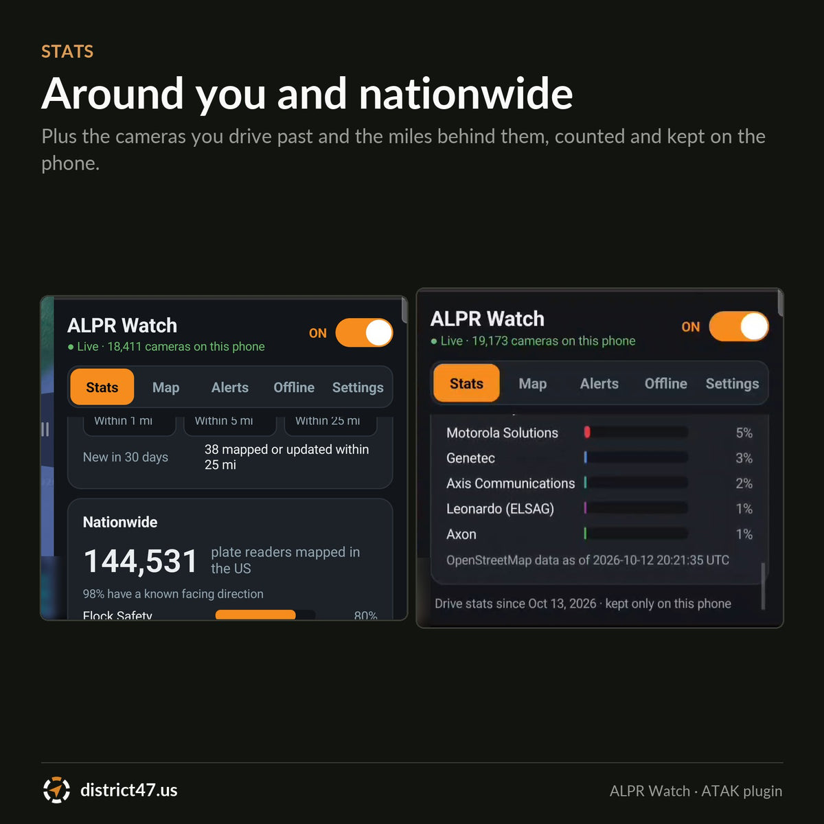
- Stats. Cameras you have driven past (total, different and today), miles tracked, alerts, cameras per 10 miles, the vendors you pass most, cameras within 1, 5 and 25 miles of you, and every vendor's share nationwide. Reset any time.
- Five icon styles. Camera, ALPR, badge (vendor letter), sign or dot, all colored by vendor.
- Updated daily. New and corrected cameras from OpenStreetMap arrive the next day. The phone checks every 15 minutes and downloads only what changed.
REQUIREMENTS
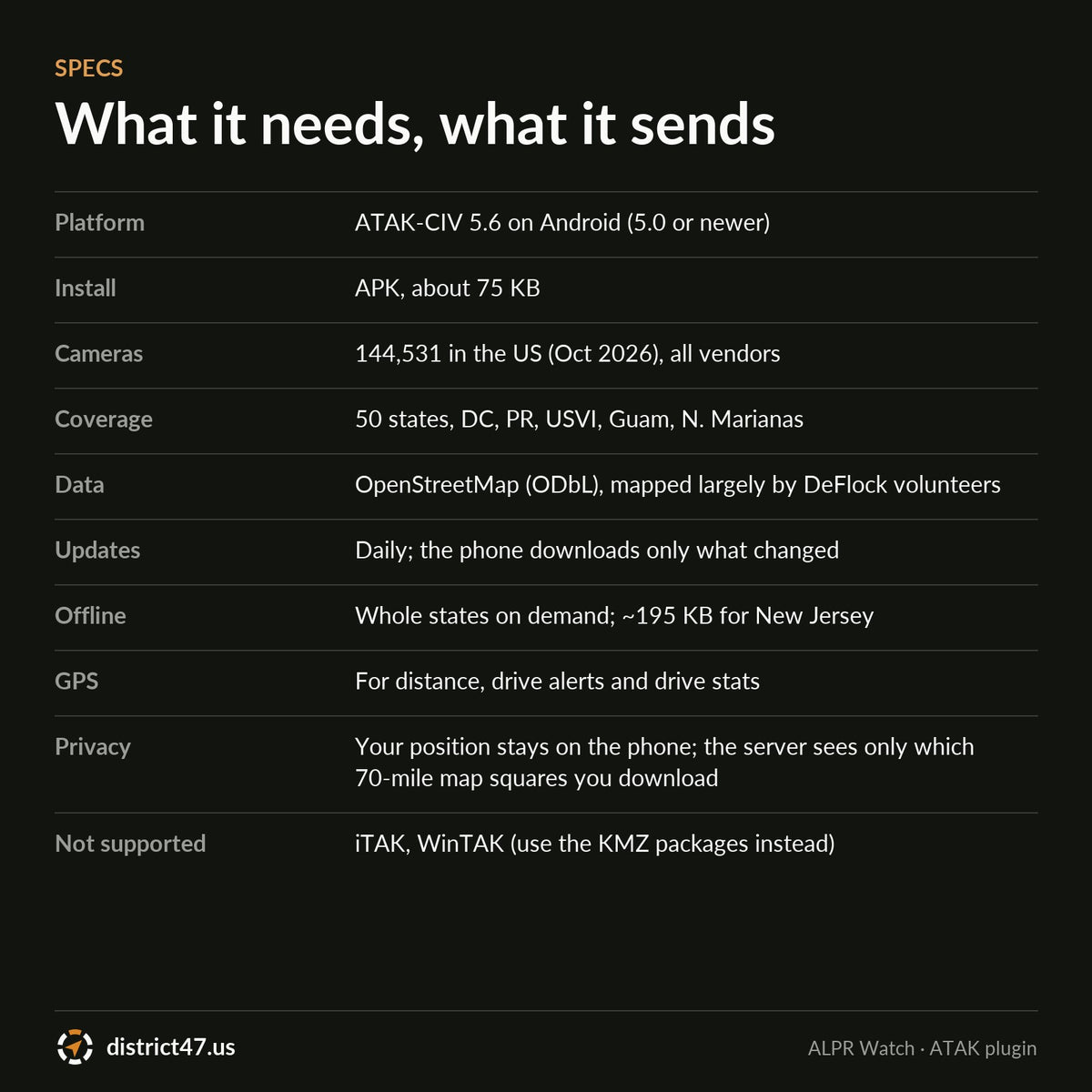
- ATAK-CIV 5.6 on Android 5.0 or newer
- APK, about 75 KB
- A data connection for the first download of an area; after that the map works offline
- GPS for distances, drive alerts and drive stats
HOW TO INSTALL
- Check out. It's free; the download link arrives by email.
- Copy the APK to your Android phone and install it.
- Open ATAK and tap OK when it offers to load ALPR Watch.
- Open ALPR Watch from the ATAK tools menu. Cameras appear once you zoom in to a few counties across.
FIELD NOTES
The map is only as complete as OpenStreetMap. Volunteers add and correct cameras every day (around 180 changes a day this month), but some areas are mapped more thoroughly than others, and a camera that was moved or removed can stay on the map until someone corrects it. If you find one missing, add it on openstreetmap.org or with the DeFlock app; it shows up in ALPR Watch the next day.
Drive alerts use a straight line along your direction of travel, so on a sharp curve a camera can warn late or not at all. Treat them as a heads-up, not a guarantee.
Your position stays on the phone. Alerts, distances and stats are worked out on the device; the server only sees which map squares (about 70 by 55 miles) the phone downloads.
Camera locations © OpenStreetMap contributors, available under the Open Database License (openstreetmap.org/copyright), mapped largely by DeFlock volunteers. Flock Safety, Motorola Solutions, Genetec, Axis and other vendor names are trademarks of their owners. District47 is not affiliated with any camera vendor.
DISTRICT47 · district47.us