District47
FREE ATAK/TAK Aware (iPhone) Public Tornado Shelter Map
FREE ATAK/TAK Aware (iPhone) Public Tornado Shelter Map
Couldn't load pickup availability
⚠️ Disclaimer: This data is intended for educational and informational purposes only. Always do your own research and validation before relying on any shelter location. Prep ahead of time and give yourself ample time to reach a shelter before a tornado event — once a warning is issued, it may already be too late.
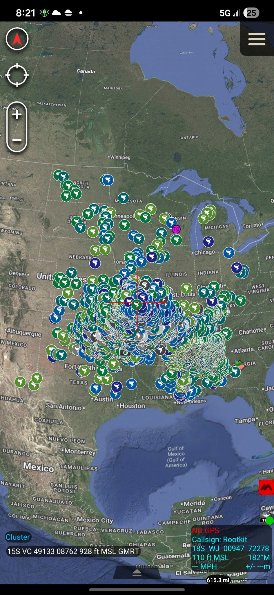
🌪️ US Public Tornado Shelters – KMZ Map Package
A comprehensive, compiled map of public tornado shelters across the United States, ready to import directly into your TAK-compatible app or mapping software. Know where to go before you ever need it.
📅 Data accurate as of: March 6, 2026
🎨 Icon Color Key – Shelter Capacity:
🟢 Medium Green — Up to 59 🟩 Dark Green — 60 to 149 🩵 Turquoise — 150 to 399 🔵 Medium Blue — 400 to 999 🟦 Dark Blue — 1,000 or more
🔘 Gray Icons — School/institutional shelters (generally limited to students and staff during school hours, though limited public capacity may be available during major events. Schools are often dismissed early to allow public shelter use.)
⬜ Light Gray — Up to 399 🩶 Medium Gray — 400 to 999 ⬛ Dark Gray — 1,000 or more
📋 Important Notes:
- The county is listed for each shelter — monitor local media or contact your local emergency management office to confirm shelters are open during an event
- Not all shelters are guaranteed to be open during every event due to staffing, maintenance, or other unforeseen circumstances
- Some locations are intentionally excluded for the following reasons:
- Not consistently open to the public (e.g., business-hours only, or restricted to residents of a specific community)
- Classified as "safer places" but not engineered to withstand winds well in excess of 200 mph
- Location could not be visually verified or confirmed
- Designed for non-tornado events (e.g., hurricanes) or post-event use only
Compatible With:
- ✅ ATAK (Android Team Awareness Kit)
- ✅ WinTAK
- ✅ TAK Aware
- ✅ Google Earth
- ✅ Any KMZ-compatible mapping application
How to Import: Download the .kmz file and import directly into your preferred app. No setup required — all icons, color coding, and location data load instantly.
📦 Delivered as a single .kmz file — instant download.
Map produced by Meteorologist Craig Ceecee, Ph.D. for Find Your Tornado Shelter LLC. Any commercial use must be authorized by the author prior to use. Map is subject to change without notice.
Share